Mobility tracking

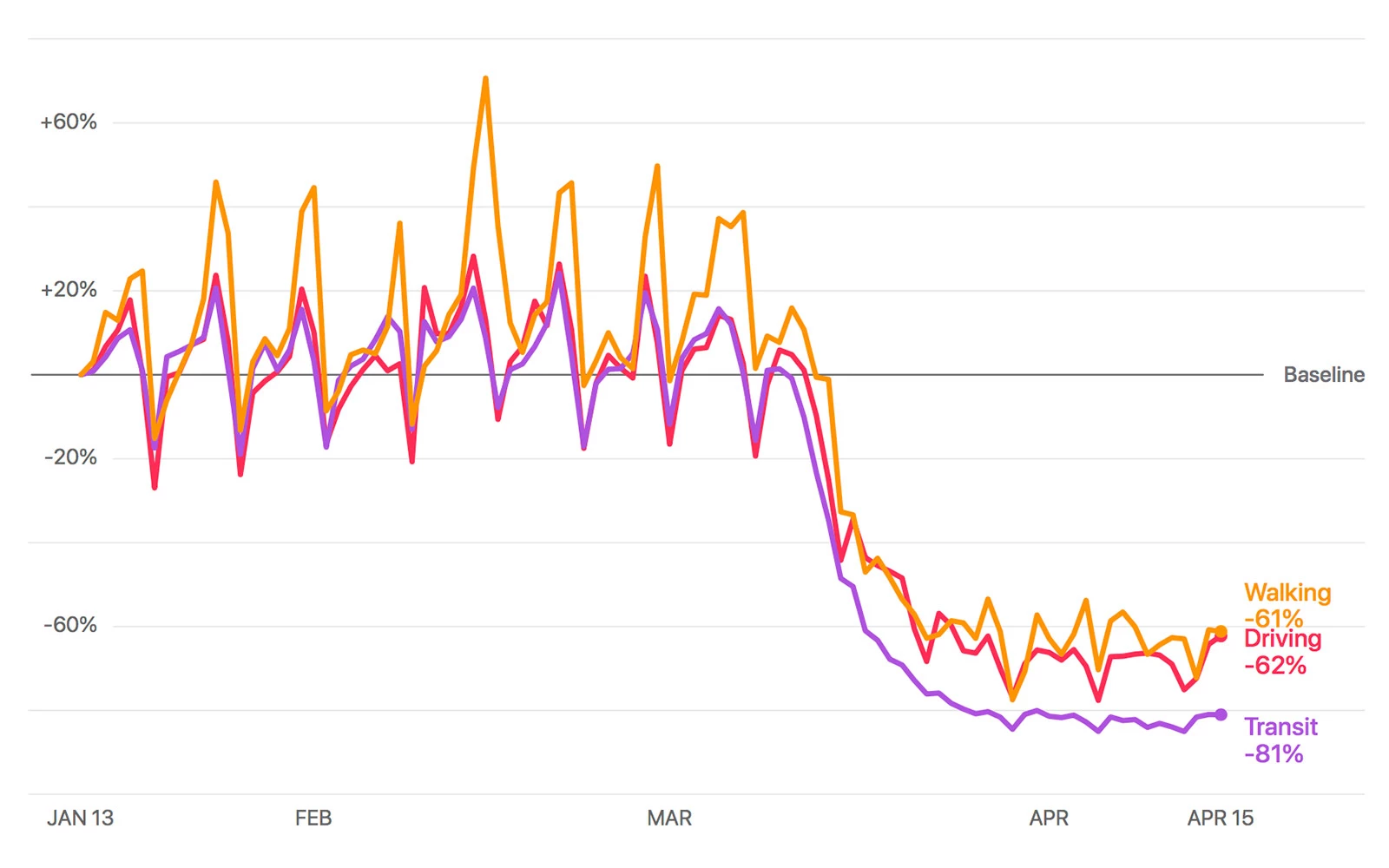
Mobility trends report for Montreal. © Apple.
Apple has released a new tool, available to the general public, to track mobility trends broken down by type of transportation (driving, walking, public transit) in different countries and major cities. The data is generated by the requests made to Apple Maps for directions. The tool complements Google’s tool, which charts movements broken down by type of destination, like retail stores, parks, office buildings, etc. Of course, both tools provide an eloquent visual representation of the impact of the COVID-19 crisis around the world. Apple says that Maps does not associate mobility data with users’ Apple ID or keep a history of a user’s location.
⇨ The Verge, Jay Peters, “Apple makes user location data from Apple Maps available to help COVID-19 relief efforts.”
